NZ Drones Blog

Homegrown 2025 Aerial Overwatch
As Homegrown Events Ltd wrapped up its final year in Wellington, NZ Drones was proud to provide aerial overwatch, ensuring a safe and seamless experience for thousands of festival-goers.
With real-time drone surveillance, our team delivered critical aerial intelligence, helping security teams stay ahead of the game and keep the event running smoothly.
🔵 Live monitoring to enhance rapid security response
🔵 Real-time aerial feeds for instant situational awareness
🔵 Advanced thermal & zoom technology for comprehensive coverage
From crowd management to rapid incident detection, NZ Drones is at the forefront of event security, using cutting-edge UAV solutions to safeguard major events across New Zealand.
Want to elevate security at your next event? Let’s talk!

Welcome 2025! - NZ Drones
Welcome to 2025! We want to extend a massive THANK YOU to all our amazing clients, both long-standing and new, for your support and trust in us. You’ve helped us achieve incredible heights, and we’re excited to keep soaring with you this year!
From aerial photography, asset inspections, and security to mapping, advertising and creative, we’re ready to deliver innovative solutions for your projects in 2025.
Let’s make this year one of growth, creativity, and success. Contact us today -we can’t wait to work with you!
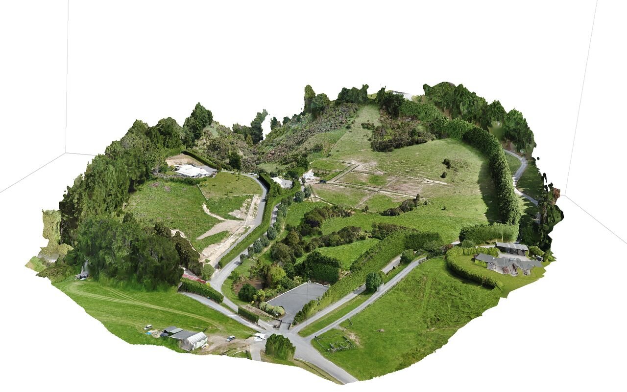
Imagine transforming your project with data that's precise, actionable, and unparalleled in accuracy
Imagine transforming your project with data that's precise, actionable, and unparalleled in accuracy. Our advanced aerial mapping solutions offer precisely that.
High-resolution data that supports smarter decision-making.
Expertise in national and international drone operations.
Comprehensive services tailored to your unique needs.
Leverage the power of aerial mapping with NZ Drones for an elevated perspective.
info@nzdrones.co.nz
www.nzdrones.co.nz
#AerialMapping #PrecisionData #TechnologyInConstruction


Roofing Inspections - NZ Drones
Roofing Inspections with NZ Drones using drones is the best tool for the job here’s why.

Testimonial Te Toi Mahana
We are a brand-new charitable trust, Te Toi Mahana. We engaged NZ Drones at very short notice to provide aerial footage of our housing. It was essential to us that our tenants could go to our brand-new website and see their communities reflected in the images on our home page. The footage provided was very high quality and gave us several options to choose from, allowing us to rotate content regularly. NZ Drones was great to work with from start to finish. We received this wonderful feedback from one of our tenants this week after our website went live “The drone video in the background on the home page is outstanding. I can't stop watching it!”.
We would highly recommend NZ Drones and the team.
Angelique Jackson - Chief Executive | Kaiwhakahaere Matua

Aerial Mapping
Aerial mapping, utilizing technologies like drones, provides numerous benefits:
🔹Comprehensive data collection over large areas.
🔹 High-resolution imagery for detailed analysis and planning.
🔹Terrain modelling and mapping for urban planning and land management.
🔹Environmental monitoring for conservation and resource management.
🔹Disaster management and response support.
🔹Infrastructure planning and maintenance optimization.
🔹Efficient surveying and mapping with reduced costs.
🔹Precision agriculture for improved yields and sustainability.
🔹Cultural heritage preservation and documentation.
🔹Scientific research and exploration in various fields.
Aerial mapping revolutionizes data collection, analysis, and decision-making across industries and applications.
For more information, please get in touch with us at info@nzdrones.co.nz

Bridge Inspections - With NZ Drones
One of the significant benefits of using drones for bridge inspection is the cost savings it offers. By incorporating drone technology, bridge owners and operators can reduce inspection expenses, resulting in a more cost-effective solution.

Jubilee Bridge Inspection
Great feedback on the benefit of using drones from a recent operation with one of our clients on a recent bridge inspection.
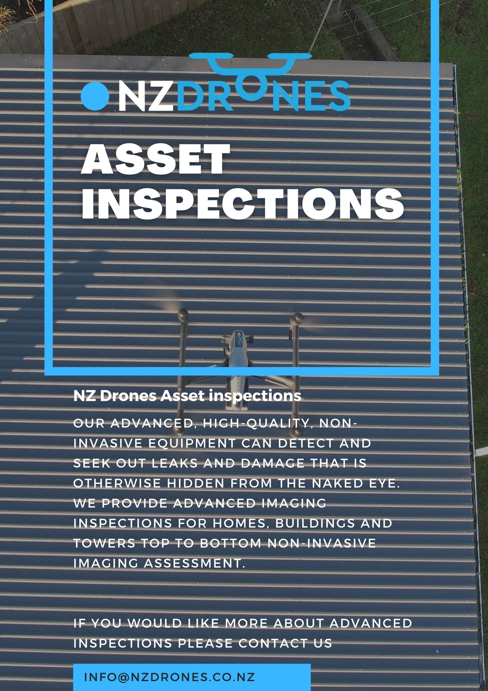
Drone Asset Inspections
Drone inspections offer a cost-effective and efficient way to gather data and conduct inspections in a variety of industries. They can save time, reduce costs, and improve safety for workers in hazardous environments.

NZ Drones are able to conduct unmanned aircraft Thermal wildlife surveys
*Pest Control*
NZ Drones has been conducting aerial thermal wildlife surveys in remote areas.
If you would like to know more about this service please get in touch with us at info@nzdrones.co.nz
Please get in touch with us if you require any Drone operations.

Aerial Mapping - Farm Mapping NZ Drones
Consider precision mapping for your farm to boost productivity! Assess vegetation health and crop measures. Contact us for a quote—New Zealand-wide service is available!

TAKING DRONE SAFETY SERIOUSLY
Date of article 2020
The chief executive officer of NZ Drones may be only 19 years old,
but he’s taken on his responsibilities regarding safety like someone
who’s grown wise with years of experience and close calls.

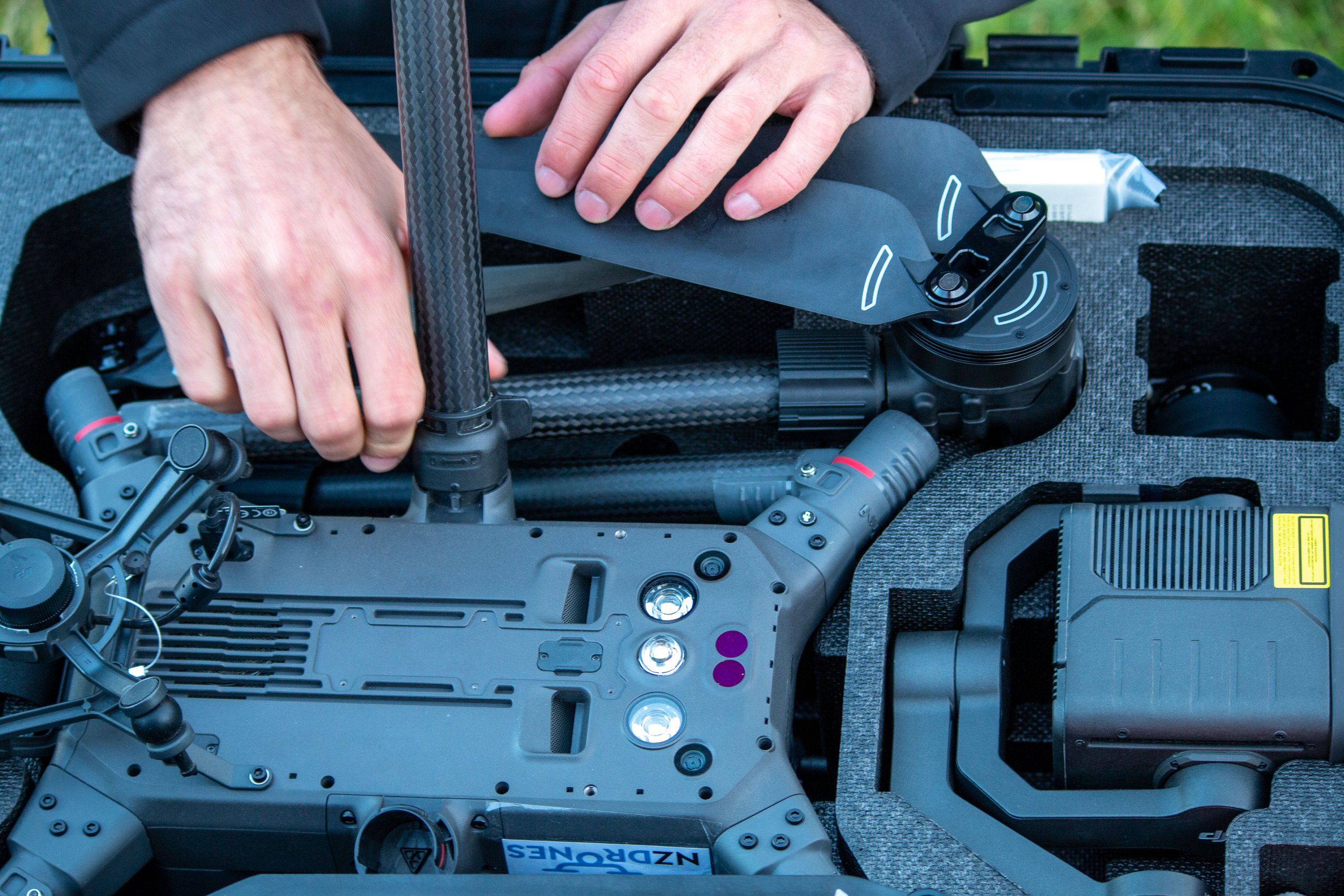
NZ Drones welcomes the DJI M300 RTK into our fleet.
NZ Drones welcomes the DJI M300 RTK into our fleet.
This aircraft is revolutionary to the Drone industry with 40 to 55 minute flight time with outstanding weather capability IP45 rating and amazing hot-swappable batteries, incredible 6 Directional Sensing & Positioning sensors equipped ADS B.
Also equipped with H20T 20MP/ 4K camera with hybrid optical zoom 23x -200x with an IR radiometric 640x512 sensor.
We are ready to elevate our existing clients and new ones '’ visions with our new M300!


Safety & Technology
Utilising the latest in drone technology we can achieve breathtaking dynamic shots.
Asides from looking good, our new generation aerial rigs are built to be safe and reliable. These are features that NZ Drones have built themselves on. This is where our equipment and experience shine. Safety always comes first.

NZDF R70 Skyranger
Great week last week with NZDF and Cratos Limited doing a bit of training and evaluation on the R70 tether and Strom Caster-L.
Click the link below to see the Storm Caster-L in action!

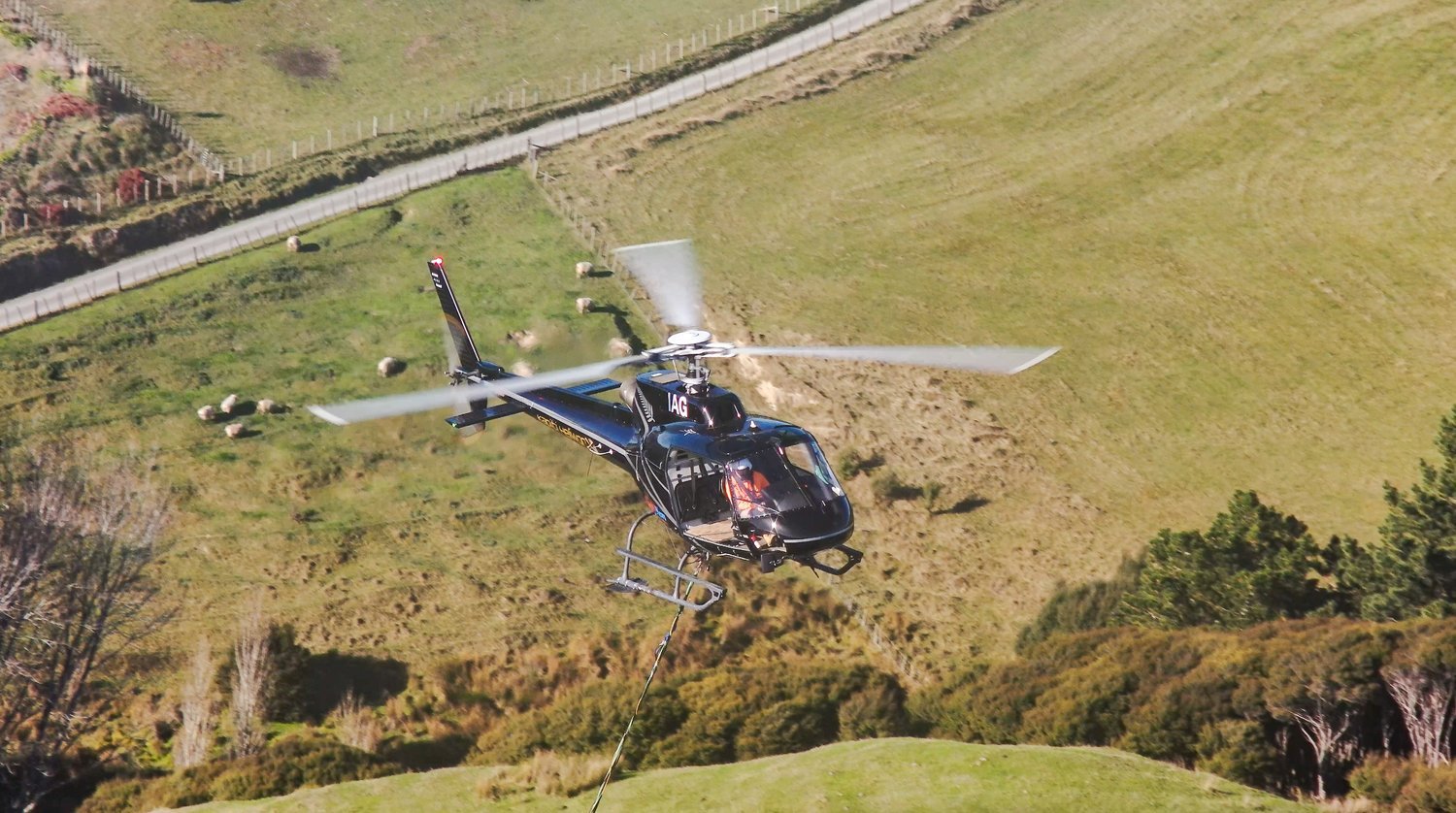
NZ Drones High Tension Powerline Work
Aerial filming a high tension powerline changeout out using I2 Dual Ops with Jack Scott and Keith Bennett
The outgoing high tension cables have been in service for around 50 years