Aerial Mapping - Farm Mapping NZ Drones
Ever thought of precision mapping of your farm?
This could improve productivity? Check out the health of your vegetation or measure the crop in the paddock!
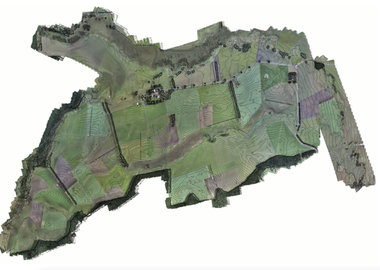
A good map is an important part of any farming operation. It can be used to add value to your business on many levels, from compliance, planning, management discussions, feed budgets and record keeping.
Drones are revolutionising the way that New Zealand farmers can operate more effectively.
For a quote, please contact us at info@nzdrones.co.nz
New Zealand Wide Service Available